Orientation
Hartland, Connecticut: A Valley Flooded for Hartford's Water
Hartland, Connecticut

Hartland's name is a contraction of "Hart(ford)land": the tract was granted to Hartford proprietors and appeared on tax lists as "Hartford land" by 1720, shortened after landowners organized the Proprietors of Hartland in 1733. Thomas Giddings, the first permanent settler, arrived in 1754, and the General Court incorporated Hartland in 1761 as the colony's 69th town. In the late 1920s the Metropolitan District Commission bought Hartland Hollow, built the Saville Dam through 1940 and flooded the valley to create the Barkhamsted Reservoir, relocating over 1,000 people and four cemeteries and splitting the town into East and West Hartland. Population collapsed from an 1800s high of 1,318 to just 296 by 1930, recovering to 1,901 at the 2020 census. Asher Benjamin, born here, wrote America's first architectural pattern books.
Getting there
Hartland has no rail station and no transit — visitors drive, almost always via Route 20, the scenic two-lane road running the length of the town, connecting west to Route 8 in Winchester and east to I-91 at Windsor Locks via the Bradley Airport Connector. Route 181 meets Route 20 at the reference junction for Tunxis State Forest, and Route 179 runs east of the Barkhamsted Reservoir. The nearest passenger rail is the CTrail Hartford Line station in Windsor Locks, reached by driving Route 20 east; Metro-North and Shore Line East do not reach this part of the state.
A state forest and a rescued farmhouse
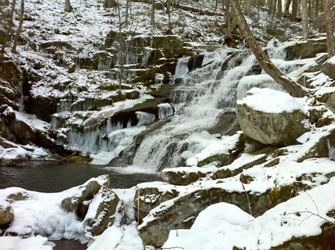
Tunxis State Forest, whose first land purchase came in 1923, covers most of northern Hartland, with DEEP's own directions to Howell's Pond, the Falls Brook Trail and a CCC-era ski area all measured from the Route 20/Route 181 junction in Hartland. The Gaylord House Museum, a six-room 1845 house built by architect Elias Gilman, was nearly demolished after the Metropolitan District Commission bought it in 1930; local advocates saved it, and the Hartland Historical Society has run it as a museum since restoring it in the 1980s, with a standing schedule of first-Sunday openings, May through October. The Mill District Preserve, a 117-acre North Woods Land Conservancy property in West Hartland, sits between two branches of the Farmington River, adjoining several other conserved tracts for longer linked walks.
What's here
-
The Coach Stop
Hartland's own restaurant, on the Route 20 corridor.
-
Tunxis State Forest
Waterfalls, a state boat launch and a CCC-era ski area.
-
Mill District Preserve
117 acres between two branches of the Farmington River.
-
Gaylord House Museum
An 1845 house museum, rescued from demolition and restored.
Questions
How do I get to Hartland?
By car — Route 20 runs the length of the town, connecting Route 8 in Winchester to I-91 at Windsor Locks. There is no rail station or transit in Hartland; the nearest passenger rail is Windsor Locks on the CTrail Hartford Line.
Is there a train to Hartland?
No. Hartland has no rail line of its own. The nearest station is Windsor Locks, reached by driving Route 20 east.
What happened to Hartland Hollow?
Starting in the late 1920s, the Metropolitan District Commission bought the valley, built the Saville Dam through 1940 and flooded it to create the Barkhamsted Reservoir, relocating over 1,000 people and four cemeteries and splitting the town into East and West Hartland.
Foliage
Near peak this week · estimated peak Oct 14–20
On the Hartford West foliage driving route.
Derived from the Connecticut DEEP fall foliage map. DEEP's map is a climatological estimate last published in 2023; it describes a normal year, not this one. Stage names are ours. See the statewide forecast.
Connected pages
Nearby
-
Granby, Connecticut: Cider Distilling and a Notch on the Massachusetts Line
· Granby, Connecticut
Hartland borders Granby to the east.
-
Barkhamsted, Connecticut: A Reservoir, a Chair Factory and a Lighthouse
· Barkhamsted, Connecticut
Hartland borders Barkhamsted to the south; the Barkhamsted Reservoir, built by flooding Hartland Hollow, straddles both towns.
-
Colebrook, Connecticut: A Mizner Mansion in the Green Woods
· Colebrook, Connecticut
Hartland borders Colebrook to the northwest.
Shared history
-
Barkhamsted, Connecticut: A Reservoir, a Chair Factory and a Lighthouse
· Barkhamsted, Connecticut
The Metropolitan District Commission's Saville Dam flooded Hartland Hollow to create the Barkhamsted Reservoir, which forms the two towns' shared border.
Same region
-
New Hartford, Connecticut: Ovation Guitars and Satan's Kingdom
· New Hartford, Connecticut
New Hartford sits southwest of Hartland along the Farmington River.
-
East Granby, Connecticut: A Copper Mine Turned Colonial Prison
· East Granby, Connecticut
Both on the Hartford West foliage route
-
Granby, Connecticut: Cider Distilling and a Notch on the Massachusetts Line
· Granby, Connecticut
Both on the Hartford West foliage route