Sherman, Connecticut: The Forgotten Founder's Namesake Town
Sherman, Connecticut
Pictures from Sherman
See all 3 photos →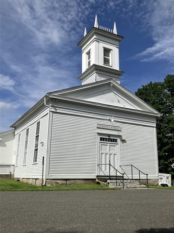
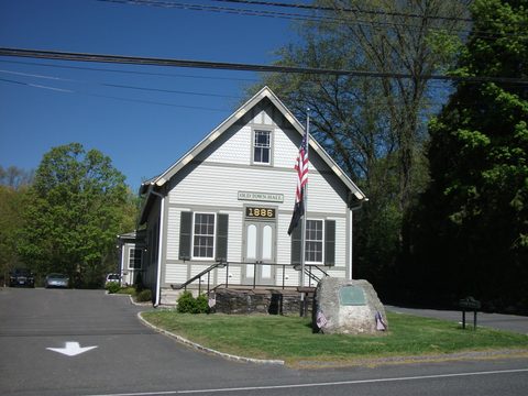
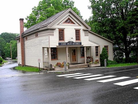
Sherman was incorporated in 1802, split off from the northern portion of neighboring New Fairfield, and named for Roger Sherman — the only Founding Father to sign all four of the nation's founding documents. The underlying land traces to a 1729 purchase: Fairfield settlers, approved in 1724 to form a township, bought a roughly 31,000-acre tract covering today's New Fairfield and Sherman for 65 pounds sterling. Sherman is the northernmost and least-populous town in Fairfield County, bordering New York State to the west. Candlewood Lake, completed in 1928, forms Sherman's eastern shoreline and engulfed the southern portion of the town's farmland when it was built. In the 1800s Sherman was known for superior tobacco leaf; working farms survive today on land protected by the Naromi Land Trust.
-
sight
A community theater since 1926.
-
sight
The Historical Society's main museum.
-
A restored village store.
-
sight
Small-batch wines from farm-grown fruit.
-
sight
Hiking trails overlooking Candlewood Lake.
-
The AT crosses Sherman's northwest corner.
-
sight
The town's public library.
-
food
The anchor of the village center, since 1993.
-
food
The town's early-morning coffee-and-sandwich stop.
The Forgotten Founder's town
Roger Sherman signed the Articles of Association, the Declaration of Independence, the Articles of Confederation and the U.S. Constitution — the only person to sign all four. The Sherman Historical Society runs a Roger Sherman Learning Center by appointment and keeps its main museum in the Northrop House. The road between Sherman Center and New Milford, today's Route 37, was once the New Milford and Sherman Turnpike, chartered in 1818; the Sherman Historic District, centered on the Route 37/39 junction, was added to the National Register on July 31, 1991.
Getting there
Sherman has no rail station and no interstate of its own. Route 37, an 18.66-mile road beginning at I-84 in Danbury, runs through New Fairfield and Sherman — as Greenwoods Hill Road through Pootatuck State Forest, then Barnes Hill Road — to US Route 7 in New Milford; Route 55, just 2.64 miles long, runs from the New York state line to US Route 7 in Gaylordsville. The nearest rail is Metro-North's Danbury Branch at Danbury, south on Route 37, or the lightly used Harlem Valley-Wingdale station across the New York line.
Frequently asked questions
- How do I get to Sherman?
- By car — Route 37 north from I-84 in Danbury through New Fairfield, or Route 55 west from US Route 7 at Gaylordsville. There is no train station in Sherman.
- What was Roger Sherman's connection to the town?
- The town is named for him. He is the only Founding Father to sign all four founding documents of the United States: the Articles of Association, the Declaration of Independence, the Articles of Confederation and the Constitution.
- Is White Silo Farm & Winery open year-round?
- No — it's open late April through December, Friday-Sunday 11 a.m.-6 p.m. (Fridays to 8 p.m. in July and August), plus Memorial Day, July 4th and Labor Day.
- Is there a hotel in Sherman?
- No lodging inside Sherman could be verified. The nearest option is the Fife 'n Drum Restaurant & Inn in Kent, about 12 miles north.
Foliage
Near peak this week · estimated peak Oct 14–20
On the Traditional New England foliage driving route.
Derived from the Connecticut DEEP fall foliage map. DEEP's map is a climatological estimate last published in 2023; it describes a normal year, not this one. Stage names are ours. See the statewide forecast.
Connected pages
Nearby
-
New Milford, Connecticut: Roger Sherman's Town Green
· New Milford, Connecticut
The road between Sherman Center and New Milford, today's Route 37, was once the New Milford and Sherman Turnpike.
-
Kent, Connecticut: Iron Furnaces and a Covered Bridge
· Kent, Connecticut
The two towns share a border
-
New Fairfield, Connecticut: Squantz Pond on Candlewood's Shore
· New Fairfield, Connecticut
The two towns share a border
Shared history
-
New Fairfield, Connecticut: Squantz Pond on Candlewood's Shore
· New Fairfield, Connecticut
Sherman split off from the northern portion of neighboring New Fairfield in 1802.
Same region
-
Danbury, Connecticut: Hat City History, Rail Heritage, and Where to Eat
· Danbury, Connecticut
Route 37 runs from Sherman south to I-84 in Danbury.
-
Kent, Connecticut: Iron Furnaces and a Covered Bridge
· Kent, Connecticut
Both on the Traditional New England foliage route
-
Sharon, Connecticut: The Plain of Sharon in the Northwest Corner
· Sharon, Connecticut
Both on the Traditional New England foliage route
-
Warren, Connecticut: A Bunker Hill General's Namesake
· Warren, Connecticut
Both on the Traditional New England foliage route
-
New Milford, Connecticut: Roger Sherman's Town Green
· New Milford, Connecticut
Both on the Traditional New England foliage route
What travelers think
Log in to react.
No reviews yet.