Bethany, Connecticut: A Rural Airfield's Airmail Arrow
Bethany, Connecticut
Pictures from Bethany
See all 2 photos →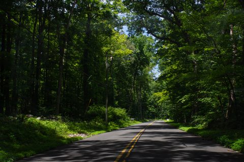
Bethany was first settled in 1717 as part of Woodbridge and separated to be incorporated as its own town in May 1832, taking its name from the biblical village. Its territory shrank twice in the 19th century: in 1844 the Straitsville area, along with parts of Waterbury and Oxford, was removed to help form Naugatuck, and the town's western section later became Beacon Falls. Dairying and agriculture were historic mainstays, and Bethany's reservoirs still serve the far larger municipalities of Naugatuck and New Haven — a role that has helped keep the town rural. Bethany Airport opened in 1923 and served early airmail flights before closing in 1965; the Town of Bethany bought the 112-acre property in 1967, and a preserved concrete airmail navigation arrow survives on the grounds today. Bethany remains the least densely populated town in New Haven County.
-
sight
A former 1923 airfield with a preserved airmail navigation arrow.
-
sight
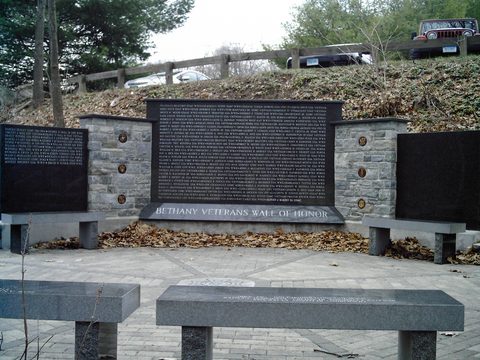
A 149-acre lake park with a swimming beach and Wall of Honor.
-
Housed in the town's renamed 1914 former Town Hall.
-
A 21-mile blue-blazed trail crossing Bethany's traprock ridges.
-
A family diner and bakery on Amity Road since 2000.
-
Diner breakfasts, pizza and Italian-American dinners.
An airfield, a lake and a wartime escape
Clockmaker Silas Hoadley was born in Bethany in 1786. Bethany native Rollin Booth Fowler flew with the 435th Troop Carrier Group and crash-landed a glider during the D-Day Normandy invasion on June 6, 1944; captured as a POW, he escaped by throwing a grenade at a German colonel's staff car and racing back to Allied lines on a commandeered German motorcycle. Veterans Memorial Park, built around Hockanum Lake, was originally a ski club property the town acquired in 1997, opening to the public in 1999 with a veterans' Wall of Honor added in 2002; it offers a swimming beach and an easy Lake Loop Trail. The Bethany Historical Society, incorporated in 1993, occupies the town's former 1914 Town Hall, renamed the Stanley Downs Memorial Building.
Getting there
Bethany is a drive-to town with no rail station, no interstate and no scheduled transit of its own. It sits midway between New Haven and Waterbury on Routes 63 (Amity Road) and 69, with Route 42 running west toward Beacon Falls and the Naugatuck Valley. New Haven Union Station, southeast down Route 63, is the nearest passenger rail hub, served by Metro-North's New Haven Line, CTrail Shore Line East, the CTrail Hartford Line and Amtrak.
Frequently asked questions
- How do I get to Bethany?
- By car — Bethany has no rail station, interstate or scheduled transit of its own. Routes 63 (Amity Road) and 69 run north-south between New Haven and Waterbury; the nearest rail is New Haven Union Station, southeast down Route 63.
- What was Bethany Airport?
- A local airfield opened in 1923 and used for early airmail flights before closing in 1965. The Town of Bethany bought the 112-acre property in 1967; a preserved concrete airmail navigation arrow and a historic hangar remain on the site, now used for soccer and equestrian fields and trails.
- Is there a hotel in Bethany?
- No hotel, motel, inn or bed-and-breakfast could be verified in Bethany, a rural town with no municipal water or sewer service. The nearest verified lodging is The Blake New Haven, a boutique hotel at 9 High Street in New Haven.
- Can I hike the Quinnipiac Trail from Bethany?
- Yes. The Blue-Blazed Quinnipiac Trail runs 21 miles through Hamden, Cheshire, Bethany and Prospect over steep traprock-ridge terrain, passing through Sleeping Giant and West Rock Ridge state parks; its northern end was extended in 2020 to Kathan Woods Nature Preserve in Prospect.
Foliage
Turning this week · estimated peak Oct 28–Nov 3
Derived from the Connecticut DEEP fall foliage map. DEEP's map is a climatological estimate last published in 2023; it describes a normal year, not this one. Stage names are ours. See the statewide forecast.
Connected pages
Nearby
-
Hamden, Connecticut: An Armory, a Ridge, and a Sleeping Giant
· Hamden, Connecticut
The two towns share a border
-
Seymour, Connecticut: From Humphreysville to a Flood-Changed Town
· Seymour, Connecticut
The two towns share a border
-
Woodbridge, Connecticut: From Amity Parish to a Printing Press
· Woodbridge, Connecticut
Bethany was first settled as part of Woodbridge before separating in 1832.
-
Beacon Falls, Connecticut: Matches, Boots and a Signal Hill
· Beacon Falls, Connecticut
Beacon Falls was carved partly from Bethany's territory in 1871.
-
Cheshire, Connecticut: Barite Mines and Bedding Plants
· Cheshire, Connecticut
The Quinnipiac Trail runs through both Cheshire and Bethany.
-
Prospect, Connecticut: The Highest Ground in New Haven County
· Prospect, Connecticut
The Quinnipiac Trail runs through both Bethany and Prospect, ending at Prospect's Kathan Woods Nature Preserve.
-
Naugatuck, Connecticut: Vulcanized Rubber and Naugahyde
· Naugatuck, Connecticut
Naugatuck was incorporated in 1844 from portions of Bethany.
Same region
-
Naugatuck, Connecticut: Vulcanized Rubber and Naugahyde
· Naugatuck, Connecticut
Bethany's Straitsville section was removed in 1844 to help form Naugatuck.
What travelers think
Log in to react.
No reviews yet.