Brookfield, Connecticut: A Craft Center in an Old Depot
Brookfield, Connecticut
Pictures from Brookfield
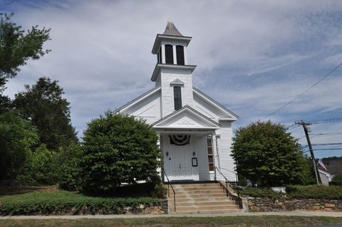
See all 3 photos →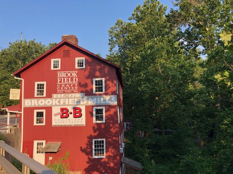
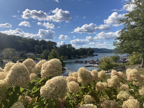
The land that became Brookfield was set off in 1752 as the Parish of Newbury, formed from pieces of Newtown, New Milford and Danbury — the parish literally borrowed parts of each town's name along with its land. The first meetinghouse was dedicated September 28, 1757, with Reverend Thomas Brooks as its first settled minister. In May 1788 the Connecticut General Assembly granted the parish town status, renaming it Brookfield in Brooks's honor; the first town meeting convened June 9, 1788, with a population of 1,018 by 1790. From about 1732, the Iron Works District along the Still River powered mills, foundries and hat factories. Candlewood Lake, Connecticut's largest man-made lake, was completed in 1928 and forms Brookfield's western edge. Brookfield Center was added to the National Register of Historic Places in 1991.
-
sight
A craft school in a former train station building.
-
Local history since 1968, plus an annual Festival of Crafts.
-
Community theater staging shows since 1957.
-
sight
A 2.25-mile paved path with a footbridge over the Still River.
-
sight
The town's Candlewood Lake swimming beach.
-
food
American tavern fare in a renovated 150-year-old building.
-
food
Independent Middle Eastern restaurant and market.
-
food
Indian food near the Danbury line.
From the Iron Works to Candlewood Lake
Brookfield's Iron Works District, settled around 1732 along the Still River, once ran furnaces, grist mills, sawmills, comb shops, carding and cotton mills, a paper mill, a knife factory and hat factories. The town held near 1,700 residents through 1950, then grew fast — 3,405 by 1960 and 9,688 by 1970 — and counts about 17,500 residents today. Brookfield once had two railroad stations, one in the Iron Works District and one called Junction Station, but passenger service through town ended with the last northbound train in April 1971. M. Jodi Rell, Connecticut's 87th governor from 2004 to 2011, lived in Brookfield from 1969 until her death in 2024 and represented the town in the state legislature.
Getting there
Brookfield has no passenger rail station of its own. Interstate 84 crosses the town's southern end, and US Route 7 and US Route 202, which run concurrently through town, form the main north-south corridor; Route 25 and Route 133 (to the Lake Lillinonah bridge and Bridgewater) fill out the local roads. The nearest train service is the Metro-North Danbury Branch terminus in Danbury, a few miles southwest, reached from the New Haven Line by a change at South Norwalk on most off-peak trips. A "Brookfield" station appears only as a proposed, unfunded stop in long-range plans to extend service north from Danbury toward New Milford.
Craft school, theater and Federal Road dining
The Brookfield Craft Center, on Whisconier Road, teaches clay, fiber, blacksmithing, glass, jewelry and woodworking in a campus that incorporates a former train station building; its gallery mounts rotating exhibitions through the year, including a 50th Annual Holiday Exhibition each winter. The Brookfield Museum and Historical Society, founded in 1968, keeps the town's local-history collections and hosts an annual Festival of Crafts each November. The all-volunteer Brookfield Theatre for the Arts has staged "quality live theatre since 1957." Federal Road carries Brookfield's dining: Market Place Tavern serves American fare in a renovated 150-year-old building, Tabouli & More is an independent Middle Eastern restaurant and market, and BarNaan serves Indian food near the Danbury line.
Frequently asked questions
- How do I get to Brookfield?
- By car — Interstate 84 crosses the southern end of town, with US Route 7/202 as the main north-south corridor. There is no passenger rail station in Brookfield; the nearest is the Metro-North Danbury Branch terminus in Danbury, a few miles southwest.
- Is there a train station in Brookfield?
- No. A "Brookfield" station exists only as a proposed, unfunded stop in long-range plans to extend Danbury Branch service north toward New Milford.
- What is the Still River Greenway?
- A 2.25-mile paved path linking the Brookfield Municipal Center to the Town Center "Four Corners" district, with entrances on Silvermine Road and Federal Road and a footbridge crossing the Still River beneath Route 7.
- Can I visit Candlewood Lake from Brookfield?
- Yes — Brookfield Town Beach on Candlewood Lake, Connecticut's largest man-made lake, is run by the town's Parks & Recreation department; call ahead for season and hours.
- Is there a hotel in Brookfield?
- No hotel or inn inside Brookfield could be verified; the area's lodging clusters a few miles southwest in Danbury and Bethel along I-84.
Foliage
Turning this week · most advanced Oct 14–20
This town never reaches full colour on the state's map — DEEP's eight weeks run out before it turns.
On the Scenic Fairfield foliage driving route.
Derived from the Connecticut DEEP fall foliage map. DEEP's map is a climatological estimate last published in 2023; it describes a normal year, not this one. Stage names are ours. See the statewide forecast.
Connected pages
Nearby
-
New Fairfield, Connecticut: Squantz Pond on Candlewood's Shore
· New Fairfield, Connecticut
The two towns share a border
-
Danbury, Connecticut: Hat City History, Rail Heritage, and Where to Eat
· Danbury, Connecticut
Brookfield borders Danbury; I-84 climbs from Danbury into Bethel and Brookfield.
-
New Milford, Connecticut: Roger Sherman's Town Green
· New Milford, Connecticut
Brookfield and New Milford both border Candlewood Lake, Connecticut's largest man-made lake.
-
Newtown, Connecticut: Scrabble, a Flagpole and a Cultural District
· Newtown, Connecticut
I-84 Exit 9 is signed jointly for Brookfield and Newtown, at CT 25.
-
Bridgewater, Connecticut: The Last Dry Town on the Housatonic
· Bridgewater, Connecticut
The two towns share a border
-
Bethel, Connecticut: Barnum's Birthplace and a Vodka First
· Bethel, Connecticut
The two towns share a border
Same region
-
New Milford, Connecticut: Roger Sherman's Town Green
· New Milford, Connecticut
Both on the Scenic Fairfield foliage route
-
Bethel, Connecticut: Barnum's Birthplace and a Vodka First
· Bethel, Connecticut
I-84 climbs from Danbury into the rural towns of Bethel and Brookfield, though the two do not share a border.
-
New Fairfield, Connecticut: Squantz Pond on Candlewood's Shore
· New Fairfield, Connecticut
Brookfield and New Fairfield both border Candlewood Lake.
-
Danbury, Connecticut: Hat City History, Rail Heritage, and Where to Eat
· Danbury, Connecticut
Both on the Scenic Fairfield foliage route
-
Ridgefield, Connecticut: Connecticut's Only Inland Battle
· Ridgefield, Connecticut
Both on the Scenic Fairfield foliage route
What travelers think
Log in to react.
No reviews yet.