
Douglaston, Queens: Douglas Manor, Douglaston Hill and Udalls Cove
Douglaston, New York
Pictures from Douglaston
See all 1 photos →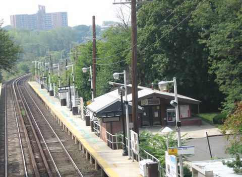
Douglaston sits on a peninsula reaching into Little Neck Bay at the eastern edge of Queens. The city's planning table files it together with Little Neck as a single neighborhood tabulation area, QN1103, within Community District 11, and its ZIP codes are 11362 and 11363. Two New York City historic districts lie within it: the Douglaston Historic District, designated in 1997, and the Douglaston Hill Historic District, designated in 2004. The Landmarks Preservation Commission's register of individual landmarks lists two in Douglaston, the Cornelius Van Wyck House of about 1735 and the Benjamin P. Allen House of 1850, and both are private houses. Udalls Park Preserve runs from Northern Boulevard to Little Neck Bay, and Alley Pond Park borders the neighborhood on the west. Northern Boulevard runs through Douglaston, and Douglaston Parkway and Marathon Parkway carry Douglaston addresses.
-
Designated in 1997 over Douglas Manor. West Drive, Shore Road, Arleigh Road, Beverly Road, Manor Road and Center Drive are residential streets.
-
sight
37-04 Douglaston Parkway, also addressed as 126 West Drive. Built about 1735, architect unknown, and a private single-family house.
-
sight
29 Center Drive, carried by PLUTO as 236-12 Center Drive. Built 1850 and designated an individual landmark on January 11, 1977. A private residence.
-
sight
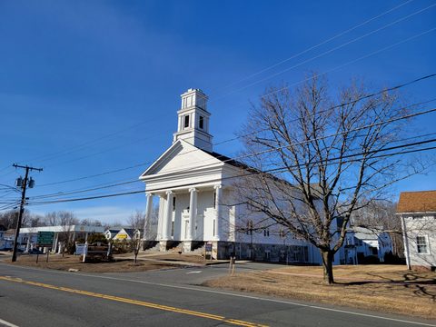
243-20 Church Street. LPC states the church stands outside the City's Douglaston Hill Historic District; the National Register district includes it.
-
walk
NYC Parks property Q452, 44.44 acres, running from Northern Boulevard to Little Neck Bay. Udalls Cove lies between the Douglaston and Great Neck peninsulas.
-
NYC Parks property Q059, 0.101 acres, on Douglaston Parkway at 240th Street between 42nd Avenue and 43rd Avenue.
-
sight
44-21 Douglaston Parkway. The league lists a "95th Annual Online Juried Open Exhibition" and gives its telephone as 718-224-3957.
-
63-20 Marathon Parkway. PLUTO records the parcel as built in 1927 and owned by NYC Parks; the course reaches beyond the neighborhood.
-
The Long Island Rail Road station at 235th Street and 41st Avenue. Wikipedia credits the 1962 station house to Allan Gordon Lorimer.
-
food
248-25 Northern Boulevard. A menu listing states that there is a grill at every table; the menu runs to Special Galbi and Prime Rib Eye.
Douglas Manor, Douglaston Hill and the two landmarks
The Landmarks Preservation Commission designated the Douglaston Historic District in 1997, in a report describing "over 600 houses and some 150 related structures"; the city's PLUTO tax-lot file counts 638 lots inside the district's boundary. The Douglaston Hill Historic District followed in 2004, and the Commission's report for it counts thirty-one buildings; PLUTO counts thirty-one lots in the district and one more in its 2007 amendment. Wikipedia's National Register summary gives the National Register's Douglaston Hill district 83 contributing buildings and two contributing sites.
Douglas Manor was one of the Rickert-Finlay Realty Company's tracts. LP-1957 sets the firm's work out in one line: "Their projects included Norwood in Long Island City, Broadway-Flushing in Flushing, Bellcourt in Bayside, Douglas Manor in Douglaston, and Westmoreland in Little Neck."
The Cornelius Van Wyck House is one of the two individual landmarks. The 1966 designation entry gives it as "CORNELIUS VANWYCK HOUSE, 37-04 Douglaston Parkway (126 West Drive), Douglaston, Borough of Queens. Built about 1735, architect unknown. Landmark Site: Borough of Queens Tax Map Block 8056, Lot 62." PLUTO gives the same year. Of 5,583 PLUTO lots in ZIP codes 11362 and 11363, five carry a year built before 1900 — this house at 1735, 221 Arleigh Road and 236-12 Center Drive at 1850, 240-02 Poplar Street at 1850, and 231 Manor Road at 1870 — and the Van Wyck House is the earliest of them by 115 years. The Commission continued its public hearing on the designation to February 8, 1966, when four speakers spoke in favor, and the report records that "There were no speakers in opposition to designation at either meeting." PLUTO gives the owner as Van Wyck House, LLC and a single residential unit.
The Benjamin P. Allen House, also called the Allen-Beville House, stands at 29 Center Drive, the address in its LPC designation; PLUTO carries it as 236-12 Center Drive in ZIP 11363, built in 1850, with one residential unit and a private owner. The LPC dataset dates the designation to January 11, 1977, and the report's own header gives the landmark site as Block 8064, Lot 76. PLUTO also files the house inside the Douglaston Historic District.
The Wynant Van Zandt House at 600 West Drive is the Douglaston Club, and PLUTO gives the owner as Douglaston Club Inc. LP-1957 dates the house to 1819 with alterations after 1906, while PLUTO's year for the lot is 1931. It is a contributing building in the Douglaston Historic District rather than an individual landmark, and the club is private. The Commission's 1977 report on the Allen House records that William P. Douglas won national standing when his yacht Sappho defeated British challengers in the competition that has since become the America's Cup.
Zion Episcopal Church is at 243-20 Church Street, and the parish gives its mailing address as 243-01 Northern Boulevard. Its rectory at 242-02 44th Avenue is described in LP-2155 as nearly identical to a house inside the New York City Douglaston Hill Historic District, and the same sentence states the rectory is "not in the historic district." The church stands outside that district as well: both LP-2155 and LP-1957 state that "Zion Church is located outside the historic district," and LP-2155 records the new Zion Episcopal Church of 1924-25 as not located inside it either. Wikipedia's National Register summary lists Zion Episcopal Church of 1830 among the contributing buildings of the National Register's Douglaston Hill district.
LP-1957 identifies 216 Beverly Road as Alfred Scheffer's own house, and attributes the mansion at 1008 Shore Road to Buchman & Fox. It also records 233 Arleigh Road as the site of the Great White Oak. The tree was cut down in 2009.
The bay, the preserve and the parkway
Udalls Park Preserve is filed by NYC Parks as property Q452, 44.44 acres, in Community Board 11, and it has no street address; Parks gives its extent as "Northern Blvd., 244 St. to 247 St., Douglas Rd., Little Neck Bay." The cove it protects is shared ground. The Udalls Cove Preservation Committee writes that "Udalls Cove is an inlet of Little Neck Bay... between the Douglaston and Great Neck peninsulas," describes the Ravine as "a deep wooded gully that lies between Little Neck and Douglaston," and records that "Much of the area has been acquired by New York State and City, and the Village of Great Neck Estates."
The committee tells its own founding story this way: "Then one woman said, 'Enough.' Aurora Gareiss, a feisty, middle-aged Douglaston resident whose home looked out on Udalls Cove, determined that what was left of the wetlands and woods around the Cove should be conserved."
NYC Parks sets the local landforms out on its historical sign for the preserve: "These are the peninsulas of Great Neck, Bayside, and Douglaston that flank the pre-glacial river valley of Little Neck Bay and Udall's Cove." Alley Pond Park borders Douglaston on the west.
Catharine Turner Richardson Park is NYC Parks property Q059, 0.101 acres, in ZIP 11363, and it too has no street address; Parks gives its extent as "Douglaston Pkwy., Prospect Ave. bet. Poplar St. and Pine St." Douglaston Park Golf Course has its clubhouse at 63-20 Marathon Parkway, on a parcel PLUTO records as built in 1927 and owned by NYC Parks; PLUTO measures that tax lot at 50.0 acres, NYC Parks gives the golf course property as 104.6 acres, and the course reaches beyond the neighborhood.
The National Art League's gallery is at 44-21 Douglaston Parkway; the league gives its telephone as 718-224-3957 and lists a "95th Annual Online Juried Open Exhibition." The Immaculate Conception Center is at 72-45 Douglaston Parkway, held on the tax roll by Rocklyn Ecclesiastical Corp.; the center's own site describes over 80 acres, while PLUTO's tax lot for it measures 27.5 acres. Douglaston Plaza is at 242-02 61st Avenue. FDNY Engine 313 and Ladder 164 are quartered at 44-01 244th Street. Queens Public Library's Douglaston/Little Neck branch, named for both neighborhoods, is at 249-01 Northern Boulevard, and its North Hills branch is at 57-04 Marathon Parkway.
The Douglaston and Little Neck Historical Society serves both Douglaston and Little Neck. So does the Little Neck - Douglaston Memorial Day Parade Organization, Inc., whose route Wikipedia gives as running "from Great Neck to Douglaston Parkway along Northern Boulevard." Wikipedia records that Douglaston is "zoned for Benjamin N. Cardozo High School, in neighboring Bayside," and the NYPD's 111th Precinct serves the neighborhood from its station house at 45-06 215th Street, in Bayside.
Getting there
Douglaston station on the Long Island Rail Road is at 235th Street and 41st Avenue. Wikipedia credits its 1962 station house to the architect Allan Gordon Lorimer.
Northern Boulevard runs through the neighborhood; the Douglaston and Little Neck Historical Society records that it was formerly Broadway. Douglaston Parkway carries addresses from the National Art League at 44-21 to the Immaculate Conception Center at 72-45. Marathon Parkway carries the Douglaston Park Golf Course clubhouse at 63-20 and the Queens Public Library's North Hills branch at 57-04. Douglaston shares its ZIP codes, 11362 and 11363, and its planning-table area, QN1103, with Little Neck.
Street names in Douglaston Hill have changed since LP-2155 was written: Pine Street is now 43rd Avenue, Poplar Street is now 42nd Avenue, Prospect Avenue is now 240th Street, and Willow Street is now Depew Avenue. NYC Parks describes Catharine Turner Richardson Park by the older names.
Within the Douglaston Historic District, West Drive, Shore Road, Arleigh Road, Beverly Road, Manor Road and Center Drive are residential streets that can be walked. The Douglas Manor shorefront is held in common by the Douglas Manor Association rather than as public parkland, and the Douglaston Club, the Cornelius Van Wyck House and the Benjamin P. Allen House are all private.
Frequently asked questions
- How do I get to Douglaston?
- Douglaston station on the Long Island Rail Road is at 235th Street and 41st Avenue; Wikipedia credits its 1962 station house to the architect Allan Gordon Lorimer. By road, Northern Boulevard runs through the neighborhood, and Douglaston Parkway and Marathon Parkway carry Douglaston addresses. The neighborhood is in Queens Community District 11, and its ZIP codes are 11362 and 11363.
- Which historic districts cover Douglaston?
- Two New York City historic districts. The Landmarks Preservation Commission designated the Douglaston Historic District in 1997, in a report describing "over 600 houses and some 150 related structures"; PLUTO counts 638 tax lots within its boundary. The Douglaston Hill Historic District followed in 2004, with thirty-one buildings counted in the Commission's report, and an amendment in 2007. Douglas Manor was one of the Rickert-Finlay Realty Company's tracts, listed in LP-1957 alongside Norwood in Long Island City, Broadway-Flushing in Flushing, Bellcourt in Bayside and Westmoreland in Little Neck.
- Is Zion Episcopal Church inside the historic district?
- It depends which district. LP-2155 and LP-1957 both state that "Zion Church is located outside the historic district," and LP-2155 repeats it for the church of 1924-25 and for the rectory at 242-02 44th Avenue, which it calls "not in the historic district" — those are the New York City Douglaston Hill Historic District. Wikipedia's National Register summary lists Zion Episcopal Church of 1830 among the contributing buildings of the National Register's Douglaston Hill district. The church stands at 243-20 Church Street, with a mailing address at 243-01 Northern Boulevard.
- Which places in Douglaston are open to the public?
- Udalls Park Preserve and Catharine Turner Richardson Park, both NYC Parks properties; Douglaston Park Golf Course, whose clubhouse is at 63-20 Marathon Parkway; the National Art League's gallery at 44-21 Douglaston Parkway; and the residential streets of the two historic districts. The Cornelius Van Wyck House and the Benjamin P. Allen House are single-family houses in private hands, the Douglaston Club at 600 West Drive is a private club, and the Douglas Manor shorefront is held in common by the Douglas Manor Association rather than as public parkland.
- Who laid out Douglaston Hill and named its streets?
- LP-2155, of 2004, says that Van Beuren "sold it in 1843 to Jeremiah Lambertson, a local farmer, who held the property until 1853, when he laid it out in an urban grid, named the subdivision Marathon, and sold the lots at auction." LP-1957, of 1997, says that "William Douglas apparently attempted a suburban subdivision half a century earlier south of Douglas Manor" and that "He named a number of new streets after the abundant trees on his property (Pine, Poplar, Willow, Cherry)."
Connected pages
Shared history
-
Long Island City, Queens: the East River Waterfront, Vernon Boulevard and Court Square
· Long Island City, New York
LP-1957 lists the Rickert-Finlay Realty Company's projects as including Norwood in Long Island City and Douglas Manor in Douglaston.
-
Flushing, Queens: The Bowne House, the Old Quaker Meeting House and Main Street
· Flushing, New York
LP-1957 names Broadway-Flushing in Flushing and Douglas Manor in Douglaston among the Rickert-Finlay Realty Company's tracts.
Same region
-
Bayside, Queens: Bell Boulevard, the Bell Farm and Four Landmarks
· Bayside, New York
Douglaston is zoned for Benjamin N. Cardozo High School in neighboring Bayside, and the NYPD's 111th Precinct serves it from 45-06 215th Street there.
What travelers think
Log in to react.
No reviews yet.