
Homecrest, Brooklyn: Homecrest-by-the-Sea and the Avenue U Strip
Homecrest, New York
Pictures from Homecrest
See all 3 photos →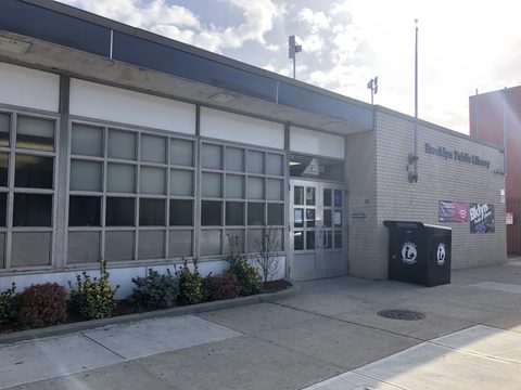
Homecrest began as an early-twentieth-century real estate subdivision. Developers put up large single-family homes in the east end of the town of Gravesend and marketed the district as Homecrest-by-the-Sea. The timing is legible in the transit record: the original at-grade station at Avenue U opened on the surface Brighton Beach Railroad near East 15th Street around 1902, described as coincident with the building of the community of Homecrest, and was replaced by the present elevated station around 1908. The neighborhood's boundaries have never settled — a 2010 walking tour placed it between about Kings Highway, Avenue X, Coney Island Avenue and Ocean Avenue, while other sources draw the lines differently — and the same tour noted that a few Victorian-style houses can still be found among the later blocks.
-
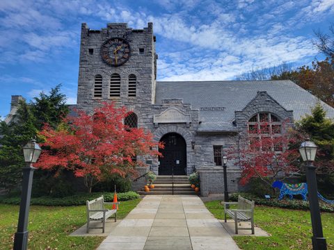
The Coney Island Avenue branch, seen on screen in A Bronx Tale and Brooklyn's Finest.
-
Courts and tennis off Avenue S, named for a Kings County postmaster and county clerk.
-
The larger of the two Kelly records, 3.449 acres at 1301 Avenue S.
-
walk
Courts, soccer fields and spray showers on Avenue V, named for two brothers who died in the Second World War.
-
walk
Ballfields and courts by the Belt Parkway, founded in 1940.
-
A Chinese seafood restaurant at 1217 Avenue U, with tanks of live seafood by the entrance and full dim sum at weekends.
-
food
A restaurant at 1223 Avenue U with live music, open Wednesday to Sunday from noon.
-
A Vietnamese restaurant at 1243 Avenue U, trading on its own site as Pho Viet Nam. Closed Mondays.
-
food
A restaurant at 1305 Avenue U whose Chinese name ends in 五味鵝, 'five spice goose.'
-
food
A bakery at 1310 Avenue U, on the strip Wikipedia describes as a Chinese enclave by the subway station.
-
food
A halal Middle Eastern and Mediterranean kitchen at 1311 Avenue U, also listed as Karavan Kebab.
-
food
A Cantonese restaurant at 1321 Avenue U, with dim sum daily and roasted meats.
Old roads and small lanes
Kings Highway, which most descriptions put along Homecrest's northern side, has colonial roots. It was a Native American trail recorded as Mechawanienck in a 1652 deed, a wagon path in a 1682 deed, and was connected out of local roads and trails into a highway by the early eighteenth century, named for Kings County — which had itself been named for King Charles II in 1683. Gravesend Neck Road, which gives the Neck Road station its name, is described as a very old colonial-era road that predates the street grid, once running to a peninsula east of today's Nostrand Avenue called Gravesend Neck that landfill has since eliminated.
Neck Road station was also once a terminus of the Long Island Rail Road's Manhattan Beach Branch, with a separate spur branching off just south of it toward the now-razed Sheepshead Bay Race Track. No LIRR line serves Homecrest today.
Margaret Court is an easy-to-miss pedestrian walkway on East 13th Street between Avenues Y and Z, lined with small houses numbered 1 to 21; a 1929 Belcher Hyde atlas shows it already existed before the surrounding blocks were built out. Homecrest Court held one of the last remaining 1950s-era porcelain street signs in New York City when it was documented in 2013; that sign has since been removed and the lane carries no street sign now.
The Avenue U storefronts
Homecrest has long had a large Italian population, joined later by immigration from Latin America, China, Israel, Syria, Russia and South Asia. A Chinese enclave grew up right by the Avenue U subway station; the framing of it as Brooklyn's second Chinatown traces to bklynr rather than to Wikipedia, which describes the enclave without using that phrase.
The Avenue U storefronts on this page include Wing Hing Seafood Restaurant at 1217, Sheep by Barashka at 1223, Pho Vietnam Restaurant at 1243, Yuanzaibing at 1305, Long Wong Bakery at 1310, Karavan Grill at 1311 and Season Restaurant at 1321.
Where Homecrest gives way to Madison along Avenue U is not settled. The sources that describe Homecrest's edges disagree with one another and none should be treated as definitive, and the commercial strip carries on past these addresses into blocks commonly grouped with Madison.
Getting there
The BMT Brighton Line runs through Homecrest, with stations at Kings Highway, Avenue U and Neck Road.
Kings Highway station, at Kings Highway between East 15th and East 16th Streets, sits on the border of Midwood and Homecrest. The Q stops there at all times and the B stops there on weekdays — rush hours, middays and early evenings — as an express.
Avenue U station, at Avenue U between East 15th and East 16th Streets, sits on the Homecrest and Sheepshead Bay border, served by the Q at all times.
Neck Road station, at Gravesend Neck Road between East 15th and East 16th Streets, is in Homecrest and is served by the Q at all times.
Frequently asked questions
- How do I get to Homecrest?
- By Q train, which stops at all times at Kings Highway, Avenue U and Neck Road on the BMT Brighton Line. Neck Road is in Homecrest; Kings Highway sits on the Midwood border and Avenue U on the Sheepshead Bay border. The B also stops at Kings Highway on weekdays during rush hours, middays and early evenings.
- Where are Homecrest's boundaries?
- Sources disagree and none should be treated as settled. A 2010 walking-tour account places the neighborhood between about Kings Highway, Avenue X, Coney Island Avenue and Ocean Avenue; other accounts use Avenue V or Avenue U as the southern edge, East 16th Street or Ocean Parkway on the sides, and Avenue P on the north. The edge it shares with Madison along Avenue U is unsettled in the same way.
- Where does the name come from?
- From Homecrest-by-the-Sea, the early-twentieth-century real estate development that put up large single-family homes in the east end of the town of Gravesend. A 2010 walking-tour account gives the same origin for the name.
- Where can I eat on Avenue U?
- The addresses on this page run from 1217 to 1321: Wing Hing Seafood Restaurant, Sheep by Barashka, Pho Vietnam Restaurant, Yuanzaibing, Long Wong Bakery, Karavan Grill and Season Restaurant.
- Why are there two Kelly parks?
- The city's parks-properties data carries two separate records under the name Kelly Park Playground in ZIP code 11229 — a 1.447-acre site at 1840 East 16 Street and a 3.449-acre site at 1301 Avenue S. NYC Parks' historical sign at the smaller one refers to a larger neighbor west of the BMT Brighton Beach transit line also named for William E. Kelly, and Wikipedia separately describes a William E. Kelly Memorial Park on Avenue S. Both records are listed here.
- Are there hotels in Homecrest?
- No. A query of the city's property dataset for ZIP code 11229, Homecrest's primary ZIP, returned no property carrying a hotel building class. The neighboring guides linked from this page cover the surrounding area.
Connected pages
Nearby
-
Sheepshead Bay, Brooklyn: A Fishing Fleet and a Lost Racetrack
· Sheepshead Bay, New York
Avenue U station sits on the Homecrest and Sheepshead Bay border, and Neck Road station is in Homecrest immediately adjacent to Sheepshead Bay.
-
Midwood, Brooklyn: Vitagraph, Fiske Terrace and Avenue J
· Midwood, New York
Kings Highway station, at Kings Highway between East 15th and East 16th Streets, sits on the border of Midwood and Homecrest.
Shared history
-
Gravesend, Brooklyn: Lady Moody's Patent and the Old Burying Ground
· Gravesend, New York
Homecrest began as Homecrest-by-the-Sea, a development of large single-family homes in the east end of the town of Gravesend.
Same region
-
Madison, Brooklyn: Avenue U and a High School Name
· Madison, New York
The Avenue U commercial strip runs through both, and neither neighborhood's edge along it is fixed by any authority.
-
Gerritsen Beach, Brooklyn: Bungalows, Vollies and the Point
· Gerritsen Beach, New York
Kings Highway station, the subway connection recorded for Gerritsen Beach, sits on the border of Midwood and Homecrest.
What travelers think
Log in to react.
No reviews yet.