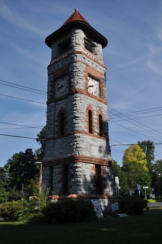

Elmhurst, Queens: Newtown's Village, Four Landmarks and the Whitney Avenue Grid
Elmhurst, New York
Pictures from Elmhurst
See all 1 photos →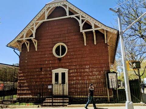
Elmhurst is a Queens neighborhood bounded by Roosevelt Avenue on the north, the Long Island Expressway on the south, Junction Boulevard on the east and the New York Connecting Railroad on the west. The Landmarks Preservation Commission dates its founding to 1652, as Middleburgh, an outpost of New Amsterdam, and it was the population center of the larger town of Newtown before the Cord Meyer Development Company built it out and it took a new name from its elm trees. Four individual New York City landmarks stand here, and there are no historic districts and no scenic landmarks: Old Saint James Episcopal Church and the Reformed Dutch Church of Newtown on Broadway, Newtown High School on 90th Street, and the Elks Lodge on Queens Boulevard. The Landmarks Preservation Commission records that by the 1980s immigrants from 112 countries had settled here. Elmhurst is covered by ZIP code 11373 and sits in Queens Community Board 4.
-
86-02 Broadway. LPC calls it New York City's oldest Church of England building and the City's second oldest religious building still standing.
-
85-15 Broadway. Church of 1831, hall of 1860, with an octagonal bell tower and a churchyard on the Corona Avenue side. Designated July 19, 1966.
-
sight
48-01 90th Street. C.B.J. Snyder's Flemish Renaissance Revival addition of 1917-18 carries a 169-foot tower topped by a cupola and turrets.
-
82-10 Queens Boulevard. Built 1923-24 by The Ballinger Company, opened October 26, 1924, with a bronze elk by Eli Harvey on the front terrace.
-
Near Corona Avenue and 90th Street. On the Preservation League of New York State's Seven to Save list; the city de-mapped the cemetery in 1931.
-
walk
6.22 acres, Park ID Q492, on the site of the KeySpan gas holders known as the Elmhurst gas tanks. NYC Parks says KeySpan sold the site to the City for $1.
-
In the northeast corner of Elmhurst Park: a semi-enclosed granite memorial, illuminated at night, honoring Queens residents who fell in the Vietnam War.
-
1.98 acres at Broadway, 82nd Street and 45th Avenue, on the site where Captain Samuel Moore built a house in 1661.
-
sight
0.63 acres on Whitney Avenue, dedicated to Elmhurst's World War I dead. Walentyna Janta-Połczyński's house stood adjacent to it.
-
1.54 acres on Broadway, developed by the WPA in 1937 and named in 1993 for the Queens District Attorney behind Hitchcock's "The Wrong Man."
-
57-02 Hoffman Drive. The 1928 theater's name is a portmanteau of Elmhurst and Woodhaven; the church opened here in 2006.
-
87-11 Whitney Avenue, on the street Wikipedia says has the most religious institutions in Elmhurst. The building was originally a synagogue.
-
walk
A green triangle at 56th Avenue, Justice Avenue and 90th Street, named for Horse Brook, the creek buried in the first three decades of the 20th century.
-
sight
88-01 Queens Boulevard, opened 1965. Its cylindrical plan came of Mary Sendek's refusal to sell the corner house at 55th Avenue and Queens Boulevard.
Broadway, Queens Boulevard and the four landmarks
Old Saint James Episcopal Church, now Old Saint James Parish Hall, stands at 86-02 Broadway, which the Landmarks Preservation Commission places "at the southwest corner of Broadway and 51st Avenue within the central district of Elmhurst, Queens"; the designation report's header also carries the address 85-08 51st Avenue. The deed was dated April 19, 1733 and signed by seventy-eight freeholders, the frame was raised in May 1735, and the church was completed in 1736. LPC's summary makes a carefully two-part claim for it: "It is New York City's oldest Church of England (Episcopal) building and the City's second oldest religious building that is still standing." An 1882 newspaper account and a 1954 parish history both record a separate room for enslaved people in the tower, reached by a "small stairway [that] led …to an upper room called 'the slave room,' which was directly on a level with the pulpit and had a window opening into the church." The building was designated on September 19, 2017, and in 2004 it was restored to its late 19th-century appearance using grants from the New York Landmarks Conservancy's Historic Properties Fund and other sources. The St. James Church cemetery is at 84-07 Broadway.
The Reformed Dutch Church of Newtown and Fellowship Hall, at 85-15 Broadway, was designated on July 19, 1966. LP-0138 gives the church as built in 1831 and the hall in 1860, calls the church "one of the oldest wood churches in the City," and describes "a beautiful octagonal bell tower with copper roof … supported on a square base which straddles the ridge of the roof at the west end." Of the graveyard it says: "From the Corona Avenue side, the cemetery, with its many remaining headstones, has the appearance of a small colonial village churchyard." The first church on the site was completed by the congregation in 1735 using volunteer labor and was replaced by the present one in 1831, with the original cornerstone reused in the new foundation; in 1965 random width aluminum shingles were applied over the original wood shingles. The Fellowship Hall was built as a chapel, standing to the south and apart from the church, and in 1906 it was moved back from the street and aligned with the main church. LPC found the two buildings, considered as a group, to be "one of the few all wood church groups remaining in the City."
Newtown High School, at 48-01 90th Street, was designated on June 24, 2003. C.B.J. Snyder, Superintendent of School Buildings for the Board of Education, designed a Flemish Renaissance Revival-style addition in 1917-18 with stepped gables and a 169-foot, centrally-placed tower topped by a cupola and turrets; LPC writes that his choice of style "showed his awareness of New York's, and particularly Elmhurst's, beginning as a Dutch colony." Construction was delayed until 1920 by the First World War, by a February fire in the Superintendent's drafting rooms that destroyed the entire set of drawings, and by problems with the contractor. Ground was broken on July 1, 1920, the cornerstone was laid on December 2, 1920, and the new wing opened in September 1921 with fifteen additional classrooms, five laboratories, a music room, a study hall, a lecture hall, two gymnasiums, offices and an 1,100 seat auditorium named Dillingham Hall for James Darius Dillingham, principal from 1894 through the mid-1930s. Two further wings admitted students on February 2, 1931, adding thirty-five classrooms, another gymnasium and specialty rooms including one called the "girls' corrective training room." LPC's 2003 report describes a student body of 4,500 and more than 200 teachers.
On Queens Boulevard, the Benevolent and Protective Order of Elks, Lodge Number 878 was built in 1923-24 to designs by The Ballinger Company at 82-10 Queens Boulevard, and was designated on August 14, 2001. LP-2086 records that the segment of Queens Boulevard through Elmhurst "was completed in 1923, the same year that construction of the Elks Lodge began." The lodge, founded in 1903 and meeting until then at Lodge 828 in Long Island City, bought the land in 1921; construction started in October 1923, and the building, which cost $750,000, opened on October 26, 1924. Besides a pool and gymnasium it held six bowling alleys, indoor hardball courts, a grille room, a barber shop, a game room, lockers, lounges, a dining room, a kitchen, office space, a main meeting room with space for 2,000 people and twenty-eight bedrooms; the interior is not part of the designation. A bronze statue of an elk based on a prototype designed for the club by the "noted sculptor, Eli Harvey" stands on the front terrace, and the annual "Elks Bazaar" included raffling off two dozen Cadillacs. Membership peaked in the 1960s at 6,600 and had fallen below 600 by 2000, and the building was sold to the New Life Fellowship Church in 2001.
Queens Place, at 88-01 Queens Boulevard, opened in 1965, bounded by Queens Boulevard and by Justice, 55th and 56th Avenues and designed in a cylindrical shape; it had been planned as a rectangle, and was redesigned because Mary Sendek, who owned the corner house at 55th Avenue and Queens Boulevard, refused to sell what had been her childhood home. Queens Center, at 90-15 Queens Boulevard, opened on September 12, 1973 and was renovated and expanded onto the far side of 92nd Street in 2002-4; it was built on land previously occupied by a 24-ride children's amusement park named Fairyland, which opened in 1949 and closed in 1968. LP-2086 notes that development in Elmhurst included "the borough's first enclosed shopping mall, which opened in 1973," without naming the building.
The Queens Public Library's Elmhurst branch is at 86-07 Broadway. NYC Health + Hospitals/Elmhurst is at 79-01 Broadway; NYC Parks records that City Hospital, now that institution, moved from Roosevelt Island in 1957. The First Presbyterian Church of Newtown, at 54-05 Seabury Street, is on the National Register of Historic Places — Wikipedia's listings table gives September 9, 2013 — but it is not a New York City individual landmark. The Rock Church occupies the former Loew's Elmwood Theatre at 57-02 Hoffman Drive, a 1928 building whose name was a portmanteau of "Elmhurst" and "Woodhaven"; the theater closed in 2002 and the church opened there in 2006.
Wikipedia records that Whitney Avenue "has the most religious institutions of any street in Elmhurst," and that the street runs from 83rd Street in the west to Roosevelt Avenue and 93rd Street to the northeast on a tilted grid developed in the early 20th century, alongside Aske, Benham, Case, Denman, Elbertson, Forley, Gleane, Hampton, Ithaca, Judge, Ketcham, Layton and Macnish Streets. Christian Testimony Church is at 87-11 Whitney Avenue in a building originally a synagogue, as evidenced by the former presence of the word Mizpah above the front door, with a congregation composed mainly of Chinese people and services in both English and Mandarin Chinese; Elmhurst Baptist Church is at 87-37 Whitney Avenue in a building constructed of stone. Elsewhere are Ascension Roman Catholic Church at 86-13 55th Avenue, the Elmhurst Islamic Center at 87-07 55th Avenue, the Elmhurst Muslim Center at 42-12 79th Street, Masjid Al Taufiq at 41-02 Forley Street, the Bangladesh Hindu Mandir at 94-39 44th Avenue, Geeta Temple Asharam at 92-09 Corona Avenue, Satya Narayan Mandir at 75-15 Woodside Avenue, the Jain Center of America at 43-11 Ithaca Street, St. Adalbert Roman Catholic Church at 52-29 83rd Street, and St. Bartholomew's Church at 43-22 Ithaca Street.
Newtown, the renaming and the burial ground
LPC dates the founding to 1652, "as Middleburgh, an outpost of New Amsterdam near the west end of Long Island." Wikipedia gives the same year, spells the name Middelburgh and traces it to the capital of the Dutch province of Zeeland, "which had been a refuge of Puritans fleeing religious persecution in England"; NYC Parks' Frank D. O'Connor Playground sign writes Middleburg. The sources also part company over 1656. LP-2593 says the Algonquian-speaking Lenape, "whose settlement was known as Mas-pet or Wandowenock, agreed to share hunting, fishing and gathering lands with the colonists." The O'Connor Playground sign says the colonists approached the Lenape, "who agreed to share the surrounding territory," and that "the settlers ultimately took ownership of the property, and the Lenape were displaced." The Moore Homestead Playground sign instead credits Reverend Moore with "arranging the peaceful purchase of Newtown from the Mespeatches tribe in 1656." Elmhurst village was the population center of the town of Newtown, "an area that once extended from the East River to Flushing Bay, and from Brooklyn to today's Forest Hills and Corona." LP-2593 also reproduces a newspaper account of 1678 in which Newtown counted "183 white inhabitants and 93 Negro slaves."
The Elmhurst African American Burial Ground lies near Corona Avenue and 90th Street. The Preservation League of New York State writes that "Newtown, what is now Elmhurst, was settled by free African Americans in 1828, one of several such communities that popped up in New York City after slavery was abolished in 1827." Wikipedia records that the landowner James Hunter and his wife deeded two acres to the community for a church and parsonage in 1828, that land at Corona Avenue and 90th Street had already been used as a burial ground since about 1818, that the ground was associated with the United African Society of Newtown, known by 1906 as St. Mark's A.M.E. Church, and that more than 300 burials had been made by 1886. The League records that the church stood on the site until 1930, that officials applied for a permit to transfer all burials to Mount Olivet Cemetery and the permit was denied, that "in 1931, the city de-mapped the cemetery," and that the church is now located in Jackson Heights. In 2011, during development, the remains of a woman were found in an iron coffin; archaeological research revealed her identity as "most likely Martha Peterson, a 26-year-old African American woman buried about 150 years before," and revealed the existence of many more unmarked graves. The League names the site to its Seven to Save list, records that the ground is now developer-owned, and credits the Elmhurst History and Cemeteries Preservation Society with advocating for it.
Large-scale development began in 1896, when the Cord Meyer Development Company started operating in Newtown, and by 1910 the company "had completed thousands of houses in the community." NYC Parks says Cord Meyer (1854-1910) and his brothers "laid down streets, constructed a sewer system, brought in gas and electricity, built a bank, and set up a system of trolley cars." The renaming to Elmhurst, for the elm trees, is dated differently in every account: LP-2131 and LP-2086 both put it in 1896, LP-2086 adding that the company hoped to disassociate its housing from "nearby, foul-smelling Newtown Creek" and convinced the post office to make the change; Wikipedia gives 1897; and NYC Parks' Middleburgh Triangle sign attaches the new name to the city's consolidation in 1898. Middleburgh Triangle itself is Park ID Q069, listed by NYC Parks as a Triangle/Plaza with an acreage of 0.00. Its sign says in one sentence that the area was known as Middleburgh between 1652 and 1664, and in the next that "this triangle is named for Maspeth's original name."
Moore Homestead Playground, at Broadway, 82nd Street and 45th Avenue, is 1.98 acres and Park ID Q361. NYC Parks records that in the mid-1600s the surviving children of Reverend John Moore (1620-1657) were granted 80 acres of land in the area, and that Captain Samuel Moore (1645-1717) built a house here in 1661. Parks says the property "is also known as the birthplace of the famous 'Newtown Pippin' apple which arose from the farm of Gershom Moore, Captain Samuel Moore's brother"; Wikipedia instead places Gershom Moore at what is now the intersection of Broadway, 45th Avenue and Elmhurst Avenue. New York City adopted the Newtown Pippin as its official apple on December 31, 2013. The Board of Transportation acquired the homestead site during construction of the Independent Subway in 1930, the buildings were razed in 1933, the property became Elmhurst Playground in 1954, and the City Council renamed it in 1987. In 1992 capital reconstruction was interrupted when workers unearthed a brick cistern formerly used to store water for the old homestead, made of European-made bricks used as ballast on ships bound for American shores. Clement Clarke Moore (1779-1863), of the same family, spent much of his boyhood at the family estate in Newtown and composed "A Visit from St. Nicholas" in 1822.
Elmhurst Park, 6.22 acres and Park ID Q492, occupies the site of two KeySpan Newtown gas holders known as the Elmhurst gas tanks, built in 1910 and 1921 and standing 200 feet high on 57th Avenue between 74th and 80th Streets; because the Long Island Expressway frequently became congested there, "backup at the Elmhurst Gas Tanks" became a familiar phrase in radio traffic reporting. Accounts of when they came down differ. The New York Times reported on September 20, 1993 that the tanks "are down, deflated forever, their skeletal remains waiting to be dismantled"; the Queens Tribune wrote that "they came down in 1996"; Wikipedia's own text says the gas storage facilities were removed in 2001. NYC Parks says the site "was sold by KeySpan to the City of New York for $1 and was cleaned up and returned to the public as open space," and that the park reopened in 2011. In the northeast corner of the park the Queens Vietnam Veterans Memorial, a semi-enclosed granite structure illuminated at night, "provides a contemplative space that honors those Queens residents who fell during the Vietnam War."
Veterans Grove, at Whitney Avenue and 43rd Avenue between Judge and Ketcham Streets, is 0.63 acres and Park ID Q013. The city acquired the land from the Cord Meyer Development Company by condemnation in 1928; it was named Elmhurst Memorial Park at the request of Elmhurst Post 298 of the American Legion and renamed Veterans Grove in September 1985. It is dedicated to the soldiers from Elmhurst who lost their lives in World War I. A World War I-era howitzer once sat in the center of the triangle; NYC Parks records that at the onset of World War II such guns "were collected and melted down," and that a plaque celebrating all Elmhurst veterans replaced it. Parks also records that the home of the humanitarian Walentyna Janta-Połczyński and her husband Aleksander was adjacent to the park, that during World War II Walentyna translated reports from the Polish Underground State into English which "revealed Nazi atrocities, including the existence of concentration camps in German-occupied Poland, to the United Nations," that they moved into the house in 1960, which "became a haven for recent migrants from Poland," and that Walentyna "stayed in the house until April 2020 when she died at the age of 107."
Frank D. O'Connor Playground, 1.54 acres and Park ID Q098, is on Broadway between Woodside Avenue and 78th Street. The Works Progress Administration developed the site into a playground and sitting area in 1937, on two parcels the Board of Transportation had permitted NYC Parks to use from 1935; the park was named in 1993, and the sitting area on the far side of 78th Street became known as O'Connor's Tail. Parks describes Frank D. O'Connor (1909-1992) as raised in Elmhurst and a graduate of Newtown High School and Niagara University, who in 1953 defended Christopher Emanuel Balestrero, "a musician who had been wrongfully accused of two holdups in Queens" — the case behind Alfred Hitchcock's 1956 film "The Wrong Man" — and who served as Queens District Attorney from 1955 to 1965, then as President of the City Council, was elected to the State Supreme Court in 1968 and was appointed to the Appellate Division by Governor Hugh L. Carey in 1976.
Newtown Playground, Park ID Q041 and 0.70 acres, is at 92nd Street and 56th Avenue. Horsebrook Island is a small triangular green space at the junction of 56th Avenue, Justice Avenue and 90th Street, named after Horse Brook, a creek that flowed to the Flushing River from the present-day intersection of Kneeland Avenue and Codwise Place and was buried in the first three decades of the twentieth century. The Department of City Planning's 2020 census data has Elmhurst primarily populated by 55,800 Asian residents and 42,600 Hispanic residents. Wikipedia describes the neighborhood's Chinatown as the second largest in Queens after Flushing's, previously a small area of Chinese shops on Broadway between 81st Street and Cornish Avenue and now reaching to 45th Avenue and Whitney Avenue. McDowell's, the fictional restaurant in the 1988 film "Coming to America," was an existing Wendy's restaurant cosmetically altered by the filmmakers for a week-long shot; it closed in May 2013 and was razed by December 2013.
Getting there
The IND Queens Boulevard Line runs beneath Queens Boulevard with stations at Elmhurst Av, Grand Av-Newtown and Woodhaven Blvd, each given as M R in MTA's station data. Two different stations carry the name Woodhaven Blvd: this one, on the Queens Boulevard Line, and another on the Jamaica Line far to the south, served by the J and Z. The IRT Flushing Line, carrying the 7, runs elevated along Roosevelt Avenue, which is the north border of Elmhurst, and 90 St-Elmhurst Av is the Flushing Line station here. MTA's data records Elmhurst Av, Grand Av-Newtown, the Queens Boulevard Line's Woodhaven Blvd and 90 St-Elmhurst Av as not accessible.
The Long Island Expressway forms the neighborhood's southern boundary and Junction Boulevard its eastern one. LP-2086 records that the segment of Queens Boulevard through Elmhurst "was completed in 1923, the same year that construction of the Elks Lodge began."
Frequently asked questions
- How do I get to Elmhurst by subway?
- The IND Queens Boulevard Line runs beneath Queens Boulevard and calls at Elmhurst Av, Grand Av-Newtown and Woodhaven Blvd, all given as M R in MTA's station data. On the elevated IRT Flushing Line, which runs along Roosevelt Avenue, the north border of the neighborhood, the 7 calls at 90 St-Elmhurst Av. MTA's data records all four of those stations as not accessible. Note that two different stations are named Woodhaven Blvd — the Queens Boulevard Line one here, and a Jamaica Line station far to the south served by the J and Z.
- Which buildings in Elmhurst are New York City landmarks?
- Four, and there are no historic districts and no scenic landmarks in the neighborhood. They are Old Saint James Episcopal Church, now Old Saint James Parish Hall, at 86-02 Broadway, designated on September 19, 2017; the Reformed Dutch Church of Newtown and Fellowship Hall at 85-15 Broadway, designated on July 19, 1966; Newtown High School at 48-01 90th Street, designated on June 24, 2003; and the Benevolent and Protective Order of Elks, Lodge Number 878 at 82-10 Queens Boulevard, designated on August 14, 2001. The First Presbyterian Church of Newtown at 54-05 Seabury Street is on the National Register of Historic Places but is not a City landmark.
- Why is the neighborhood called Elmhurst?
- For its elm trees, and the year depends on which source you read. LPC's Newtown High School report says "In 1896, Cord Meyer renamed the area Elmhurst, an allusion to the large number of elm trees in the area." The Elks Lodge report also puts it in 1896, and says the Cord Meyer Development Company hoped to disassociate its housing from "nearby, foul-smelling Newtown Creek" and convinced the post office to make the change. Wikipedia gives 1897, and an NYC Parks sign at Middleburgh Triangle attaches the new name to the city's consolidation in 1898. Before that the settlement was Newtown, and in its first years Middleburgh.
- What happened to the Elmhurst gas tanks?
- They were two KeySpan Newtown gas holders, built in 1910 and 1921 and standing 200 feet high on 57th Avenue between 74th and 80th Streets, and congestion on the Long Island Expressway made "backup at the Elmhurst Gas Tanks" a familiar phrase in radio traffic reporting. The accounts of their removal do not agree: the New York Times reported on September 20, 1993 that the tanks "are down, deflated forever," the Queens Tribune wrote that "they came down in 1996," and Wikipedia says the facilities were removed in 2001. NYC Parks says the site "was sold by KeySpan to the City of New York for $1" and reopened as Elmhurst Park in 2011.
- Where does Elmhurst begin and end?
- Roosevelt Avenue on the north, the Long Island Expressway on the south, Junction Boulevard on the east and the New York Connecting Railroad on the west, per the boundary description Wikipedia cites to the New York Times of August 4, 1985. Flushing Meadows Corona Park lies east of Junction Boulevard, beyond Corona; for the park and the institutions inside it, see the Citi Field guide. The one thread that runs back here is Horse Brook, the buried creek that flowed to the Flushing River from the present-day intersection of Kneeland Avenue and Codwise Place, and which gives Horsebrook Island its name.
- What is the Elmhurst African American Burial Ground?
- A burial ground near Corona Avenue and 90th Street. The Preservation League of New York State writes that "Newtown, what is now Elmhurst, was settled by free African Americans in 1828," and Wikipedia records that James Hunter and his wife deeded two acres for a church and parsonage that year, that the land had been used for burials since about 1818, and that more than 300 burials had been made by 1886. The church stood on the site until 1930, a permit to move the burials to Mount Olivet Cemetery was denied, and "in 1931, the city de-mapped the cemetery." In 2011 a woman's remains were found in an iron coffin during development, identified as "most likely Martha Peterson, a 26-year-old African American woman."
Connected pages
Nearby
-
Citi Field: The Ballpark and Flushing Meadows–Corona Park
· Flushing, New York
Elmhurst's eastern boundary is Junction Boulevard, and Flushing Meadows Corona Park lies beyond Corona to the east. The park's institutions are covered there.
-
Rego Park, Queens: REal GOod, the Crescents and the Remsen Cemetery
· Rego Park, New York
Elmhurst borders Rego Park to the north. The Long Island Expressway is one of Rego Park's boundaries.
Shared history
-
Jackson Heights, Queens: Garden Apartments, 37th Avenue and a Landmarked District
· Jackson Heights, New York
Roosevelt Avenue is Elmhurst's northern boundary. The Preservation League records that St. Mark's A.M.E. Church is now located in Jackson Heights.
-
Corona, Queens: The Armstrong House, Tifereth Israel and Spaghetti Park
· Corona, New York
The city's planning table files both in one district named Elmhurst-Corona, and the Wandownock Fire, Hook & Ladder 1 was founded in Newtown in 1843.
-
Forest Hills, Queens: The Gardens, the Tennis Club and Queens Boulevard
· Forest Hills, New York
The Landmarks Preservation Commission records that Cord Meyer, who bought the Forest Hills land in 1906, had previously been active in the Elmhurst section.
-
Maspeth, Queens: National Parishes, the Oval and the Expressway Triangles
· Maspeth, New York
Conflicts drove Maspeth's 1642 settlers inland to what is now Elmhurst, and Grand Avenue runs east out of Maspeth to end at Queens Boulevard there.
Same region
-
Corona, Queens: The Armstrong House, Tifereth Israel and Spaghetti Park
· Corona, New York
Elmhurst and Corona make up Community District 4, which City Planning names Elmhurst-Corona, and LPC writes of "Newtown (now Corona and Elmhurst)."
What travelers think
Log in to react.
No reviews yet.