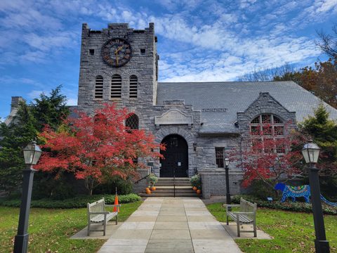

Rego Park, Queens: REal GOod, the Crescents and the Remsen Cemetery
Rego Park, New York
Pictures from Rego Park
See all 1 photos →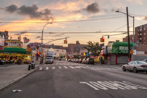
Rego Park is a Queens neighborhood bordered to the north by Elmhurst and Corona, to the east and south by Forest Hills, and to the west by Middle Village. Its boundaries include Queens Boulevard, the Long Island Expressway, Woodhaven Boulevard and Yellowstone Boulevard, it sits in Queens Community District 6, and its ZIP code is 11374. NYC Parks tells the naming story on history signs in the neighborhood's parks: the Real Good Construction Company developed the area from 1920, and in 1923 the developers Henry Schloh and Charles Hausmann named it, taking the first two letters from the first two words of the company's name. Before that the ground was farmland with a single road, Remsen's Lane, worked by Chinese farmers who grew produce for sale in Manhattan's Chinatown. The Remsen Family Cemetery, whose tombstones date from 1790 through 1819, and the alphabetized crescent streets known as the Crescents are both still here.
-
sight
Alderton Street and Trotting Course Lane. A New York City Individual Landmark under LP-1177, with tombstones dating from 1790 through 1819.
-
sight
97-30 Queens Boulevard. A Conservative synagogue, listed on the National Register of Historic Places under reference number 09000864.
-
sight
The NYC Parks sign here carries the neighborhood's naming story, and the park spans the Rego Park–Forest Hills line.
-
62nd Drive between 97th Place and 98th Street, 1.304 acres, with a history sign on the farms that preceded it.
-
sight
0.027 acres where Woodhaven Boulevard, 63rd Drive and Penelope Avenue meet.
-
walk
Asquith, Boelsen, Cromwell, Dieterle, Elwell and Fitchett — semi-circular streets the LIRR kept from ever closing into circles.
-
1.699 acres along Alderton Street, between Dieterle and Ellwell Crescents.
-
sight
Where the LIRR Main Line meets the disused Rockaway Beach Branch right-of-way, claimed by competing campaigns.
-
93-29 Queens Boulevard. NYC Parks reports it closed due to construction, so check the agency's Capital Tracker before going.
-
61-35 Junction Boulevard, the Rego Center address. Diners grill their own meat at the table, with staff on hand to help.
REal GOod: the farms, the name and the Crescents
NYC Parks tells the story on history signs in the neighborhood's parks. The Lost Battalion Hall sign reads: "Once farmland, the area had only one road, called Remsen's Lane. Chinese farmers worked the soil in an exclusive enclave, selling produce only to Chinatown. In the 1920s, the Real Good Construction bought out these farms and built one-family row houses, multi-family homes, and apartment buildings. Developers Henry Schloh and Charles Hausmann named the area in 1923, taking the first two letters from the first two words in the Real Good Construction Company's name." The Real Good Playground sign dates the company's development of the area to 1920 and spells the derivation out: "'Re' comes from Real, 'Go' comes from Good, hence Rego Park." Wikipedia instead dates the beginning of development to 1925, citing a 1930 New York Times piece; 1923 is the naming year on the city's signs.
The Horace Harding Playground sign says "Chinese farmers had owned this land and formed an exclusive farming enclave in this area, growing produce for sale in Manhattan's Chinatown," while Kevin Walsh's Forgotten New York, which carries contributed passages by Christina Wilkinson, says they "leased the land on which they grew their own crops to sell at the markets of Chinatown."
Forgotten New York describes the street pattern that followed: "The semi-circular streets were laid out and given aristocratic-sounding alphabetized names from A through F: Asquith, Boelsen, Cromwell, Dieterle, Elwell and Fitchett." The same article records that "Two lines of the LIRR, the Main Line and the Rockaway Branch, border the Crescents, and prevented them from being completed as circles," and that "The Rego Park of today fills a triangular piece of land bordered by three major Boulevards: Queens, Woodhaven and Yellowstone." Forgotten New York records Yellowstone Boulevard as "named by an early-20th century realtor; its derivation is unclear."
The Remsen Family Cemetery — Remsen Cemetery in the Landmarks Preservation Commission's designation report, Remsen Family Cemetery on NYC Parks' books — is a New York City Individual Landmark, designated under LP-1177. The report places it "between Alderton Street and Trotting Course Lane, adjoining 69-43 Trotting Course Lane, Borough of Queens," on Block 3178, Lot 44. "The oldest known grave is that of Jeromus Remsen, from 1790," and the tombstones "date from 1790 through 1819." The report calls Colonel Jeromus Remsen a figure "of American Revolutionary War fame," gives the younger Jeromus's birth as November 22, 1735, and lists the graves recorded in a 1925 survey: Colonel Jeromus Remsen, his wife Ann(a) Remsen, a Jeromus Remsen who was probably their son, three Remsen children, a Bridget Remsen and Major Abraham Remsen. Writing in 1981, it also describes a World War I memorial at the center of the cemetery, two doughboy statues flanking a flagpole.
The Rego-Forest Preservation Council's account of the neighborhood's libraries begins with a storefront library established in 1938, and then, in 1956, "a branch library, located at 91-34 63rd Drive between Austin Street and the Long Island Rail Road tracks." A fire "engulfed the entire strip of storefronts, including the library on Feb. 20, 1972, destroying it." After a period served by a bookmobile, the city bought a Shell gas station on the opposite side of 63rd Drive and erected a new library in its place; the account records major renovations to that building, at 91-41 63rd Drive, in 1989. The former library site later held the Shalimar Diner, which QNS reported "served the community for 45 years" before it was demolished by its new property owner in 2019, after an attempt to relocate it failed — the owner of the intended Riverhead site said his property had "restrictive zoning with certain architectural requirements that prohibited this type of structure." The former Mets outfielder Lenny Dykstra was part of the group that had hoped to market the relocated diner as a brewery.
Parks, a synagogue and Junction Boulevard
Lost Battalion Hall Recreation Center stands on Queens Boulevard between 62nd Avenue and 62nd Road, at 93-29 Queens Boulevard, on 2.412 acres; NYC Parks' banner for it reads "Lost Battalion Hall Recreation Center is closed due to construction. Visit our Capital Tracker page for updates on this project." Horace Harding Playground, 1.304 acres, occupies 62nd Drive between 97th Place and 98th Street, and its history sign lists Horace Harding's directorships, among them American Express, the Continental Can Company and the Southern Pacific Company. Fleetwood Triangle, at 0.027 acres, sits where Woodhaven Boulevard, 63rd Drive and Penelope Avenue meet. The Painter's Playground, 1.699 acres, runs along Alderton Street between Dieterle and Ellwell Crescents.
Real Good Playground, 1.598 acres, lies along the Horace Harding Expressway service road on 62nd Avenue between 99th Street and 102nd Street, and it spans the neighborhood line. NYC Parks' history sign there reads "The neighborhood Rego Park, where this property is located, takes its name from the Real Good Construction Company"; the agency's own page for the park prints two ZIP codes, 11374 and 11375, and the Department of City Planning's 2020 neighborhood boundary puts much of the ground on the Forest Hills side.
The Rego Park Jewish Center is at 97-30 Queens Boulevard. Its own site describes it as "a traditional Conservative synagogue that balances a commitment to the time-honored traditions and ceremonies of Halakhic Judaism with everyday life in the modern world," and gives the telephone number 718-459-1000. The building is listed on the National Register of Historic Places under reference number 09000864, on a nomination prepared by Virginia L. Bartos in June 2009. The United States Postal Service's Rego Park Station is at 92-24 Queens Boulevard, in a building the city's land records date to 1948.
At 61-35 Junction Boulevard, Alexander's, Inc. reports in its Form 10-K that Rego Park II is "a 606,000 square foot shopping center" anchored by "a 145,000 square foot Costco and a 133,000 square foot Kohl's," with "a 60,000 square foot Burlington, a 47,000 square foot Best Buy, and a 40,000 square foot Marshalls," and that the Kohl's store "is currently closed but the tenant remains obligated under its lease which expires in January 2031." Rego Park I, "a 338,000 square foot shopping center" adjoining it with a paid parking deck of 1,241 spaces, is "now vacant since the relocation of Burlington and Marshalls to Rego Park II in 2025," with the owner "in advanced negotiations with a potential buyer." The IKEA that held a lease at Rego Park I closed on December 3, 2022. The Alexander, the apartment tower above Rego Park II, "contains 312 units aggregating 255,000 square feet" and was 97.7% occupied at December 31, 2025.
The Age, writing in 2004, described Art Spiegelman's "Maus" as leaping "between Poland during the war to Rego Park, New York." And the National Endowment for the Arts lists the Bukharan Jewish singer Fatima Kuinova, born in Samarkand, as a 1992 National Heritage Fellow, filed under "Rego Park, New York."
Getting there
The 63rd Drive–Rego Park station is the neighborhood's own subway station, a local station of four tracks on the IND Queens Boulevard Line, at 63rd Drive and Queens Boulevard. Both platforms carry a blue tile band with a black border and mosaic name tablets reading "63RD DRIVE" in white sans-serif lettering on a black background, and a few of those tablets have modern metal signs above them reading "Rego Park." Beyond the platforms, an unfinished signal tower stands on the Jamaica-bound side, alongside a bellmouth that diverges to the south from the local track.
The station is not currently ADA-accessible. In July 2025 the MTA announced that it would install elevators at 12 stations, including 63rd Drive–Rego Park, as part of its 2025–2029 capital program. The 67th Avenue station, which Wikipedia describes as "on the border of Forest Hills and Rego Park," sits inside Forest Hills.
The Long Island Rail Road's Rego Park station is gone. Before it was built, two former stations near Whitepot Junction were named Matawok, for the Matawok Land Company, "which built the neighborhood surrounding the junction known at the time as 'Forest Hills West.'" Whitepot Junction, where the LIRR Main Line meets the Rockaway Beach Branch right-of-way, is still in Rego Park, and the disused branch is the subject of competing proposals. The QueensWay campaign describes its own plan as turning a 3.5-mile stretch of abandoned railway in Central Queens into a family-friendly linear park and cultural greenway. QueensLink describes its own as extending "the existing 'M' subway line south from 63rd Dr-Rego Park to the Rockaways," and says tunnelling to Metropolitan Avenue "would make it possible for all the land at White Pot Junction in Rego Park to be used for park space, community gardens, walking trails, and bike trails." Both organizations are advocates for their own schemes.
By road, Queens Boulevard, the Long Island Expressway, Woodhaven Boulevard and Yellowstone Boulevard are the neighborhood's boundaries, and Rego Park I and II front onto Junction Boulevard.
Frequently asked questions
- How do I get to Rego Park?
- By subway, to the 63rd Drive–Rego Park station on the IND Queens Boulevard Line, a local station of four tracks at 63rd Drive and Queens Boulevard. It is not currently ADA-accessible; in July 2025 the MTA announced that it would install elevators at 12 stations, including this one, under its 2025–2029 capital program. The 67th Avenue station, which Wikipedia describes as "on the border of Forest Hills and Rego Park," is in Forest Hills. The Long Island Rail Road's Rego Park station is gone. By road, Queens Boulevard, the Long Island Expressway, Woodhaven Boulevard and Yellowstone Boulevard bound the neighborhood.
- Why is it called Rego Park?
- For the Real Good Construction Company. NYC Parks' sign in Real Good Playground reads: "The neighborhood Rego Park, where this property is located, takes its name from the Real Good Construction Company, which developed this area in 1920. 'Re' comes from Real, 'Go' comes from Good, hence Rego Park." The Lost Battalion Hall sign adds that the developers Henry Schloh and Charles Hausmann named the area in 1923. Wikipedia dates the beginning of development to 1925 instead, citing a 1930 New York Times piece.
- What are the Crescents?
- A set of semi-circular streets from the neighborhood's development. Forgotten New York records that they "were laid out and given aristocratic-sounding alphabetized names from A through F: Asquith, Boelsen, Cromwell, Dieterle, Elwell and Fitchett," and that "Two lines of the LIRR, the Main Line and the Rockaway Branch, border the Crescents, and prevented them from being completed as circles."
- What is the Remsen Family Cemetery?
- A New York City Individual Landmark, designated under LP-1177 and known to the Landmarks Preservation Commission as Remsen Cemetery and to NYC Parks as Remsen Family Cemetery. The designation report places it "between Alderton Street and Trotting Course Lane, adjoining 69-43 Trotting Course Lane, Borough of Queens," on Block 3178, Lot 44. It records that "The oldest known grave is that of Jeromus Remsen, from 1790," that the tombstones "date from 1790 through 1819," and, in 1981, that a World War I memorial of two doughboy statues flanking a flagpole occupied the center of the ground.
- Is Lost Battalion Hall Recreation Center open?
- No. NYC Parks' banner for the property reads: "Lost Battalion Hall Recreation Center is closed due to construction. Visit our Capital Tracker page for updates on this project." The recreation center stands at 93-29 Queens Boulevard, on Queens Boulevard between 62nd Avenue and 62nd Road, on 2.412 acres.
- What is happening at Rego Park I and II?
- Alexander's, Inc. reports in its Form 10-K that Rego Park II, at 61-35 Junction Boulevard, is "a 606,000 square foot shopping center" anchored by a Costco and a Kohl's, and that the Kohl's store "is currently closed but the tenant remains obligated under its lease which expires in January 2031." Rego Park I is "now vacant since the relocation of Burlington and Marshalls to Rego Park II in 2025," and the owner reports being "in advanced negotiations with a potential buyer." The Alexander, the apartment tower above Rego Park II, "contains 312 units aggregating 255,000 square feet."
Connected pages
Nearby
-
Forest Hills, Queens: The Gardens, the Tennis Club and Queens Boulevard
· Forest Hills, New York
Forest Hills borders Rego Park to the east and south. The two make up Queens Community District 6, and the NYPD's 112th Precinct patrols both.
-
Elmhurst, Queens: Newtown's Village, Four Landmarks and the Whitney Avenue Grid
· Elmhurst, New York
Elmhurst borders Rego Park to the north. The Long Island Expressway is one of Rego Park's boundaries.
-
Corona, Queens: The Armstrong House, Tifereth Israel and Spaghetti Park
· Corona, New York
Corona borders Rego Park to the north, alongside Elmhurst.
Same region
-
Forest Hills, Queens: The Gardens, the Tennis Club and Queens Boulevard
· Forest Hills, New York
Both are in Queens Community District 6. The NYPD's 112th Precinct, at 68-40 Austin Street, patrols Forest Hills and Rego Park.
-
Kew Gardens, Queens: Lefferts Boulevard, Borough Hall and Maple Grove
· Kew Gardens, New York
Forgotten New York traces Austin Street along the railroad from Eliot Avenue to Metropolitan Avenue, a run that reaches Rego Park and Forest Hills.
-
Steakhouses in Queens: Eight of Sixteen on the Parrilla Belt
· Queens Steakhouses, New York
Iron Age Korean Steakhouse, at 61-35 Junction Boulevard, is a Korean beef room that qualifies here, but its place page publishes on the Rego Park guide.
See also
-
Citi Field: The Ballpark and Flushing Meadows–Corona Park
· Flushing, New York
Flushing Meadows Corona Park lies beyond the Long Island Expressway and the Grand Central Parkway, in Corona and Flushing, not in Rego Park.
What travelers think
Log in to react.
No reviews yet.