
Greenpoint, Brooklyn: Where the Monitor Was Built
Greenpoint, New York
Pictures from Greenpoint
See all 2 photos →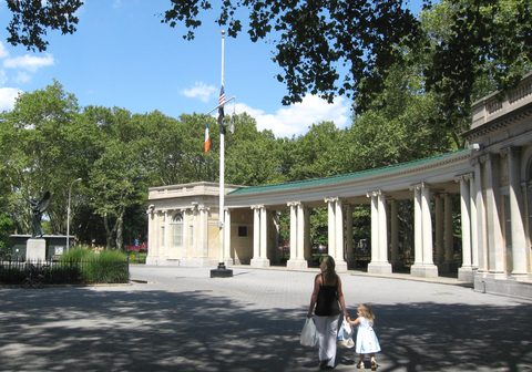
European mariners named this East River peninsula for the grassy bluff on its bank. The Dutch bought the land from the Keskachauge in 1638 and called the township Boswijck, and in 1645 the Dutch authorities granted a large tract here to a ship's carpenter, Dirck Volckertsen, known as the Norman, who built his house near what is now Calyer Street, west of Franklin Street. For almost two centuries the peninsula was farmland and stayed isolated from the rest of the region; at the time of the Revolutionary War only five families lived here. That ended in 1832, when Neziah Bliss and Eliphalet Nott bought thirty acres of farmland. Bliss had it surveyed into streets in 1834, and the first road followed in 1838. Industry and immigrants arrived immediately afterward, and Greenpoint has been rebuilding on top of them ever since.
-
walk
The 1910 shelter pavilion, the World War I memorial and the Monitor monument sit within a few paths of each other. A farmers' market runs on Sundays.
-
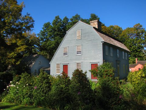
Forty-three acres of rowhouses and walk-ups built between 1850 and 1900, best seen from the sidewalks around Kent, Calyer, Noble and Franklin Streets.
-
The waterfront esplanade runs to a recreational fishing pier at the end of Kent Street, on ground that once held WNYC's radio towers.
-
The pencil works ran here from 1872 to 1956. The buildings are private — Kickstarter occupies several — so this one is looked at from West Street.
-
walk
Thirty-five acres of ballfields, courts and track shared with Williamsburg, plus the WPA-era pool that reopened in 2012 after a long closure.
-
sight
A viewing platform, an athletic field and public waterfront access on Kent Avenue, with a weekends-only pop-up section at 50 Kent Avenue.
-
Named for the barge canal terminal that stood here. Posted Parks signage on site tells the story of Greenpoint's Dutch founding.
-
sight
An independent shop on Franklin Street with book clubs and a membership program.
-
food
Wood-fired Neapolitan pizza from the Paulie Gee's kitchen, served in a dive bar on Greenpoint Avenue. Walk-ins only.
Shipyards, refineries, and the five black arts
Neziah Bliss, born in Hebron, Connecticut, was a steamboat builder and iron-works owner, and he built the connections his thirty acres needed. In 1838 he paid to erect a bridge over Bushwick Creek to the growing village of Williamsburgh, and in 1839 he backed the turnpike along what is now Franklin Street that linked Greenpoint to Williamsburgh and Astoria. The first road in Greenpoint was built in 1838, and industrialization and an influx of residents followed quickly.
What followed was shipbuilding and the five "black" arts: printing, glassmaking, pottery making, oil refining, and cast-iron manufacturing. By 1875 more than 50 oil refineries covered Greenpoint, Williamsburg, and Bushwick. Immigrants from Ireland, England, Russia, Italy, and particularly Poland arrived in large numbers during the late 1800s to work in the factories.
The ironclad USS Monitor was built at the Continental Iron Works here and outfitted at the Brooklyn Navy Yard. Antonio de Filippo's 1939 monument in Msgr. McGolrick Park commemorates the Monitor's 1862 battle with the Merrimac.
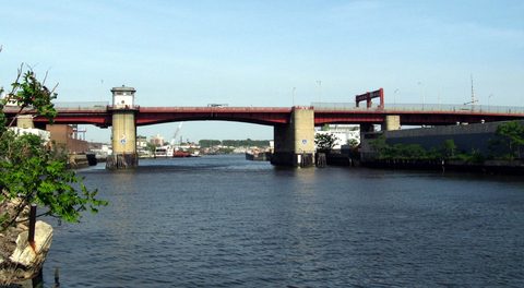
Newtown Creek, the industrial waterway bounding the neighborhood, carried the traffic. By 1915 it was one of the busiest waterways in the country: more than 100,000 ships passed through it that year alone, carrying over 5 billion tons of cargo. Then it stopped. Manufacturing and shipbuilding declined through the early 1900s, and by the end of World War II trucks and planes had largely replaced waterborne transport.
What the factories left behind is now protected. The Greenpoint Historic District — 43 acres and 363 buildings dating from 1850 to 1900 — was designated by the Landmarks Preservation Commission on September 14, 1982 and listed on the National Register on September 26, 1983. The Eberhard Faber Pencil Company Historic District on West Street followed on October 30, 2007.
Getting there
Greenpoint has two subway stations, both on the G and both inside the neighborhood. Greenpoint Avenue sits at the intersection of Greenpoint and Manhattan Avenues. Nassau Avenue sits at Nassau Avenue and Manhattan Avenue, and was the original terminal of the IND Crosstown Line when it opened in 1933. The line was extended toward Downtown Brooklyn in 1937.
NYC Ferry's East River route calls at the Greenpoint landing, at 10 India Street. The route page indicates the Greenpoint landing is served by the East River route's B branch during weekday peak hours and on non-winter weekends rather than by every sailing, so check the current schedule before relying on it.
There is no Long Island Rail Road station in Greenpoint.
Where to stay
No hotel is listed here; the lodging list is left empty rather than reaching into a neighboring neighborhood. The nearest verified options are in Williamsburg, to the south: the Wythe Hotel at 80 Wythe Avenue, in a converted 1901 brick industrial building, and The William Vale at 111 N 12th St.
Frequently asked questions
- How do I get to Greenpoint?
- The G stops twice in the neighborhood, at Greenpoint Avenue (Greenpoint and Manhattan Avenues) and at Nassau Avenue (Nassau Avenue and Manhattan Avenue). NYC Ferry's East River route also calls at the Greenpoint landing, 10 India Street.
- Where does the name Greenpoint come from?
- European mariners called the peninsula Greenpoint because of a grassy bluff on the bank of the East River. The Dutch bought the land from the Keskachauge people in 1638 and named the township Boswijck.
- What was the USS Monitor's connection to Greenpoint?
- The ironclad was built at the Continental Iron Works in Greenpoint and outfitted at the Brooklyn Navy Yard. Antonio de Filippo's 1939 sculpture in Msgr. McGolrick Park commemorates its 1862 battle with the Merrimac.
- Which parts of Greenpoint are landmarked?
- Two districts. The Greenpoint Historic District, roughly bounded by Kent, Calyer, Noble and Franklin Streets, Clifford Place and Manhattan Avenue, was designated in 1982. The Eberhard Faber Pencil Company Historic District, on West Street between Greenpoint Avenue and Kent Street, was designated in 2007.
- Why is Msgr. McGolrick Park not called Winthrop Park anymore?
- The City of Brooklyn acquired the land in 1889 and named it Winthrop Park for Assemblyman Winthrop Jones. It was renamed in 1941 for Monsignor Edward J. McGolrick, longtime pastor of St. Cecilia's Roman Catholic Church on Herbert Street.
- Is there a hotel in Greenpoint?
- No hotel is listed here. The nearest verified lodging is in Williamsburg — the Wythe Hotel at 80 Wythe Avenue and The William Vale at 111 N 12th St.
Connected pages
Nearby
-
Williamsburg, Brooklyn: Sugar, Shipyards, and a Bridge
· Williamsburg, New York
McCarren Park straddles the Williamsburg/Greenpoint border, and NYC Parks describes it as shared by both neighborhoods.
Shared history
-
Bushwick, Brooklyn: Eleven Breweries in Fourteen Blocks
· Bushwick, New York
The cities of Brooklyn, Williamsburgh and Bushwick — which then included Greenpoint — merged in 1854.
Same region
-
East Williamsburg, Brooklyn: Cripplebush and the Third District
· East Williamsburg, New York
Greenpoint and East Williamsburg are both in Brooklyn Community District 1.
-
South Williamsburg, Brooklyn: The South Side and Los Sures
· South Williamsburg, New York
South Williamsburg and Greenpoint are both in Brooklyn Community District 1.
What travelers think
Log in to react.
No reviews yet.