Orientation
Killingworth, Connecticut: A Farmer's Folk-Art Automata
Killingworth, Connecticut
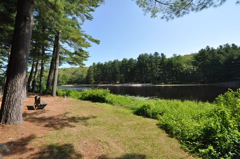

European settlement began in 1663 as a plantation called "Homonoscitt," named after the Hammonasset people; the General Assembly incorporated it as Kenilworth in 1703, and the name gradually became Killingworth. It traces to Kenilworth, England, the former home of early settler Edward Griswold, with the town named in 1667. Killingworth's original lands reached Long Island Sound and included present-day Clinton, which separated in 1838. The town's most notorious 18th-century citizen was Abel Buell, an inventor and convicted counterfeiter who engraved one of the first maps of America made by an American. In the 1890s, farmer Clark Coe built life-sized folk-art automata on his Green Hill Road farm; surviving figures are now held by the Smithsonian American Art Museum and the American Folk Art Museum.
Getting there
Killingworth is a car-first inland town with no rail station and no interstate of its own — you arrive on the two state highways that cross near the town center, CT Route 81 (Town Hall is at 323 Route 81) and CT Route 80 (Chatfield Hollow State Park is at 381 CT-80). The nearest passenger rail is Shore Line East at Clinton or Madison, south toward the shoreline.
Chatfield Hollow and Parmelee Farm
Chatfield Hollow's valley was used by Native people for hunting and shelter in its rock recesses, and later held a stream-powered grist mill; the Civilian Conservation Corps built the earth-and-stone dam that created Schreeder Pond in 1934, and the land became a state park in 1949. Parmelee Farm, a 132-acre town-owned property the town bought in 2000, keeps an 18th-century farmhouse, a stone barn and a historic one-room schoolhouse open to walkers dawn to dusk.
What's here
-
Chatfield Hollow State Park
18 miles of trails around Schreeder Pond, a former CCC dam.
-
Parmelee Farm
A 132-acre town-owned historic farm bought in 2000.
-
Platt Nature Center
A 9-acre nature center headquarters, always open.
-
Killingworth Library Association
The town's independent library, with curbside pickup.
-
Shipwreck Tavern
Neighborhood bar and restaurant with live music and trivia.
Questions
How do I get to Killingworth?
By car — Route 81 and Route 80 cross near the town center. There is no rail station or interstate in Killingworth; the nearest passenger rail is Shore Line East at Clinton or Madison, to the south.
What is Chatfield Hollow State Park?
An 18-mile trail network around Schreeder Pond, created by a 1934 Civilian Conservation Corps dam and made a state park in 1949. It offers swimming, fishing at a designated Trout Park, hiking and cross-country skiing; open daily 8 a.m.–sunset, free for in-state vehicles.
Is there a hotel in Killingworth?
No hotel, inn, motel or B&B could be verified operating inside Killingworth. The nearest verified option is Saybrook Point Resort & Marina, 2 Bridge Street, Old Saybrook, a Shore Line East station stop.
Foliage
Turning this week · estimated peak Oct 28–Nov 3
Derived from the Connecticut DEEP fall foliage map. DEEP's map is a climatological estimate last published in 2023; it describes a normal year, not this one. Stage names are ours. See the statewide forecast.
Connected pages
Nearby
-
Westbrook, Connecticut: Birthplace of the Submarine
· Westbrook, Connecticut
The two towns share a border
-
Madison, Connecticut: East Guilford's 200-Year-Old Independence
· Madison, Connecticut
The two towns share a border
-
Durham, Connecticut: A Farming Town's Second-Oldest Library
· Durham, Connecticut
The two towns share a border
-
Deep River, Connecticut: Ivory, Combs and a Steam Train Landing
· Deep River, Connecticut
The two towns share a border
-
Chester, Connecticut: A Mill Village on the River
· Chester, Connecticut
The two towns share a border
-
Clinton, Connecticut: Brownstoners, Witch Hazel, and a Harbor
· Clinton, Connecticut
The two towns share a border
-
Haddam, Connecticut: The Town the River Splits in Two
· Haddam, Connecticut
The two towns share a border
Shared history
-
Clinton, Connecticut: Brownstoners, Witch Hazel, and a Harbor
· Clinton, Connecticut
Clinton was originally part of Killingworth's lands, separating along ecclesiastical boundaries in 1838.
Same region
-
Madison, Connecticut: East Guilford's 200-Year-Old Independence
· Madison, Connecticut
Madison is one of the closest Shore Line East stations to Killingworth.
-
Deep River, Connecticut: Ivory, Combs and a Steam Train Landing
· Deep River, Connecticut
CT Route 80 runs east from Killingworth toward Deep River.